Sea Level Rise
The Hudson River connects to the Atlantic Ocean at New York Harbor, and is a brackish estuary. It is known as “the River that flows two ways” or Mahicannittuk by the Mohican nation. Rhinebeck’s waterfront is being impacted by sea level rise due to climate change.
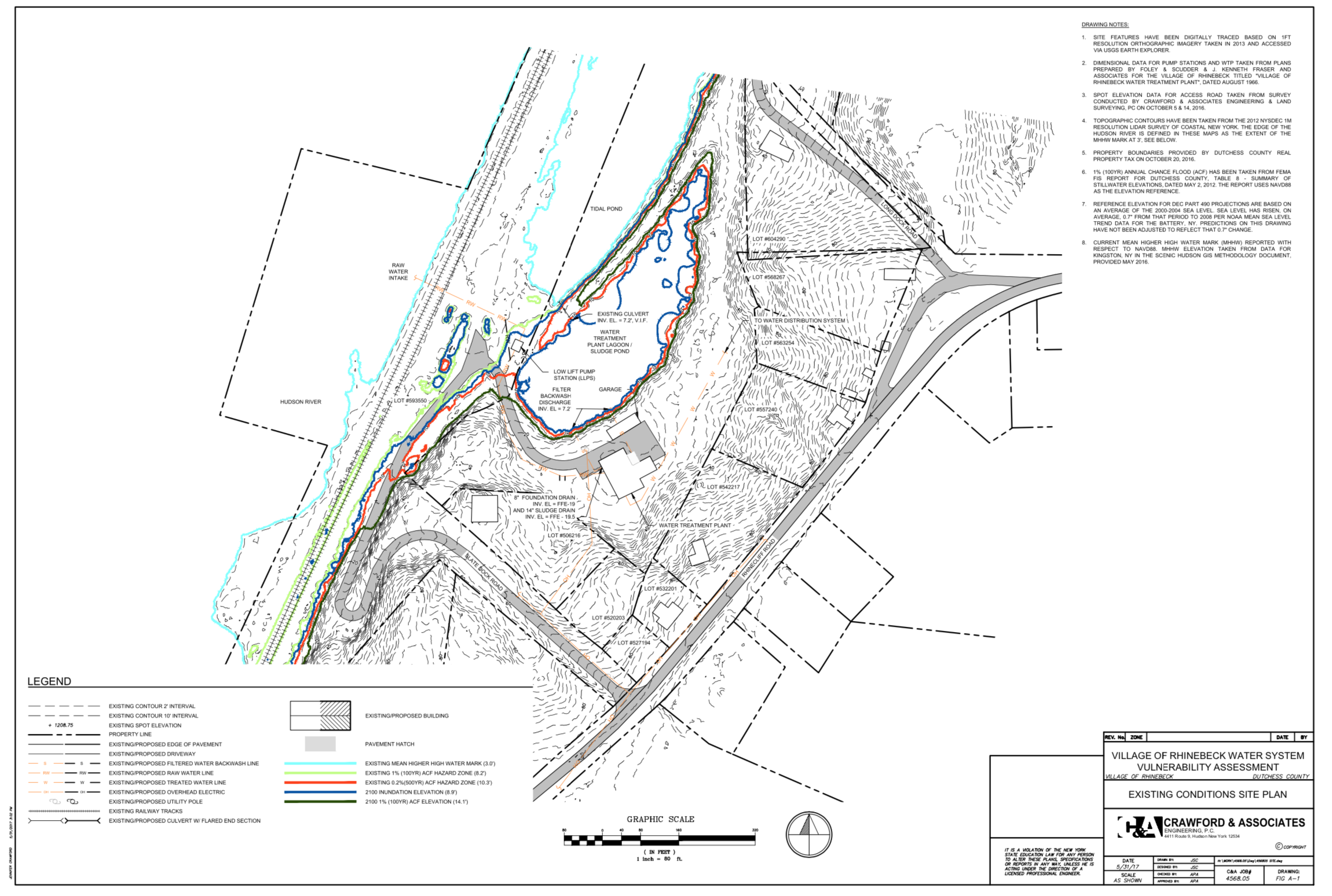
Sea level rise modeling comes from the non-profit Scenic Hudson. They developed “100-year” flood zone projections of potential sea level rise (SLR) at 12, 30, 54 and 72 inches over current levels, as well as modeling for tidal wetland pathways.
DEC recommends that siting of non-critical facilities and infrastructure include at least the medium SLR projection, while design of critical facilities, such as the Village’s Water Treatment Plant on Slate Dock Road, should include the high SLR projection. Salination of the water may also creep north with climate change and sea level rise.
In 2017, the Village did a study on Sea level rise and the impact to our WTP. We received grant money to protect our intake pumps and have completed that work. The study also suggested several other improvements that could be made.
Appendix C Storm Surge Guidance for WTP Operators (NYC Environmental Protection)